Monday 2 September 2013

Rigby Bay, Devon Island

Getting into this bay was a challenge as the charted depths were totally lousy.  If anyone from the Canadian Hydrographic Service is reading this, time to join the 21st century and take GPS tagged sounding data loggers from yachts and include them as qualified soundings when you have nothing else to show on charts!  We turned around in 3 meters of water where the charted depth was over 20 meters (West entrance to the bay). 

On the brighter side, we had a 1970s Pink Floyd moment when ashore and made a valiant attempt at stoner art.  We welcome comments that state that such valiant attempt at art was really really good and discourage any comments to the contrary (while promising tha we won't quit our day job and take up photography as a career).


Nick & Natasha, Lancaster Sound (Photo C. Ryan)

Desolation Gulch, Rigby Bay, Devon Island, Nunavut (photo Natasha Ryan)

Arctic Art Tick (photo C. Ryan)


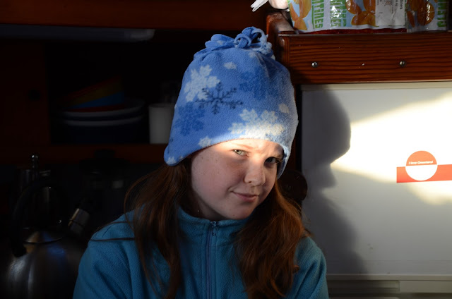
Natasha up way past her bedtime, Nunavut (photo C. Ryan)


The Three Amigos and the Night of the Long Shadows (photo N. Peissel)


Hands Up (photo C. Ryan)

Waterfall, Devon Island, Nunavut (N. Peissel)

Waterfall, Devon Island, NU (N. Peissel)


Glacier falling off the Devon Ice Field, Devon Island (C. Ryan)

Don't Bug Me (N. Peissel)


More photos from the Eastern Arctic including monster iceberg

Here are some odds and ends from Eclipse Sound, Milne Inlet, Navy Board Inlet and Bylot Island.  We measured the iceberg photographed below with a GPS device and calculated that it contained roughly 1.5 billion liters (1.5 million cubic meters) of water.  How it got there is an interesting question as the Bylot and Devon glaciers don't calve icebergs that size.  If an expert is reading this, please comment on the source of such a monster. The consensus guess on board was that it came from the Kane basin and ran aground in Eclipse Sound after drifting a few hundred miles in Ocean currents.


Accidental Life Jacket Inflation (Pull to inflate means after you get in the water, not in the boat!) - Photo N. Peissel


Bylot Island from Navy Board Inlet (N.Peissel)

Hiking on Ragged Island (N. Peissel)

A friendly cockpit UNO game (N. Peissel)

CCGS Des Groseillers in Eclipse Sound (Bylot Island in background)

Iceberg in Eclipse Sound (N. Peissel)

Iceberg estimated at 1.5 million cubic meters (N. Peissel)

Colin in Navy Board Inlet (N. Peissel)

Acalephe in Tay Bay (N. Peissel)

Birds at Tay Bay, Bylot Island (N. Peissel)

Nick at Tay Bay (photo C. Ryan)

Colin & Natasha on the beach at Tay Bay, Bylot Island (photo N. Peissel

Coolest Epic Photo Number 2 : Helicopters, sailboats, mountains, glaciers and heavy wind.

This photo was taken from the Canadian Coast Guard Icebreaker Des Groseillers.  The location is Eclipse Sound just East of Pond Inlet looking North with Bylot Island in the background.  The helicopter in the foreground adds a lot of color to what is a heavy, overcast day.  It is not known which crew member of the Desgroseillers took this photo.


The Terror of Falling Ice (movie) - A calving glacier up close

The following 2 minute video was taken with a Gopro Hero 3 Silver camera during a 30 minute dinghy ride in which two pieces calve off the glacier (the first event being larger than the second).  The video is edited down to 3 minute.

In its original high resolution format, this video is awesome.  It loses a lot of resolution in conversion to Quicktime but it is not otherwise postable.


Southbound to Arctic Bay

We had to leave one of our crew (Julie Quenneville) to fly home and winds and ice being what they were, it had to be in Arctic Bay.  We made our way there from Devon Island on what was a relatively smooth passage.  Admirality inlet gave us some great views (particularly in the middle of the night).

 Middle of the night in Admirality Inlet (photo C. Ryan)
 Admirality Inlet (M. Francoeur)
  

The Pier at Nanisivik (photo J. Quenneville)
 Our Friends in Arctic Bay (photo M. Francoeur)
  Arctic Bay with Acalephe in foreground (photo N. Peissel) 

Arctic Bay from the hill on the Victor Bay road (photo C. Ryan)
 Natasha in Victor Bay soaking up the vacation vibe (photo C. Ryan)
Thursday Night Golf Tournament in Victor Bay (photo N. Peissel)

Croker Bay Land Expedition: On the trail of Muskox and Arctic Hare

The great thing about these photos is that they were all taken between 10 p.m. and 1 am.  Love that midnight sun!


Acalephe at anchor in Croker Bay, photos N. Peissel and M. Francoeur
 

Muskox on the move, Croker Bay (photos N. Peissel)


Arctic Hare, not so well camouflaged in the summer months (photo N. Peissel)


Colin on the trail of Muskox, midnight on Devon Island


Coolest Epic Photo 1: "Yacht Meets Glacier"

Acalephe in front of glacial outflow from Devon Ice Sheet, Devon Island, Nunavut (photo N. Peissel)

Croker Bay Icebergs and Glacier

The entrance to Croker Bay is only 10 miles west of Dundas Harbour though the bay is much deeper.  We went all the way to the east glacier which was to be the Northernmost point we reached during the voyage at 74 degrees 49 minutes North,  911 nautical miles south of the North Pole.

It takes time to get up to the glaciers but it is well worth it as both glaciers were calving actively during our visit.  A single video captures in the next post capture two calving events (the first being larger) with a pretty good view of the wave generated. Below are some of the still photographs.

Multi-headed hydra iceberg, Croker Bay (photo N. Peissel)

Artful Iceberg, Croker Bay (photo N. Peissel)
Devon Ice-field East Croker Glacier (photo N. Peissel)
Colin at helm of Acalephe, East Croker glacier (photo N. Peissel)
Colin, Maud, Natasha in the dinghy, Croker Bay (photo N. Peissel)
Julie Quenneville, Jean-Gilles Lemieux aboard Acalephe, Croker Bay (photo N. Peissel)
Nick Peissel having a bad hair day, Croker Bay, NU (photo C. Ryan) 
Undermined Ice, Croker Bay (photo. M. Francoeur)

 Iceberg, Croker Bay (photo M. Francoeur)
West side, Croker Bay (photo M. Francoeur)
Dinghy Party dwarfed by ice (photo M. Francoeur)
 Flowerpot glacial edge, Croker Bay (photo M. Francoeur)
Big Ice, Croker Bay (photo J. Quenneville)
 
The Glacier Up Close (photo J. Quenneville)

Wall of Ice, Croker Bay (photo J. Quenneville)